Weather could impact post-holiday travel in the PNW, Central-South, and Midwest

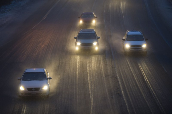
Freezing rain, snow and fog might complicate post-holiday travel in the Midwest and Pacific Northwest, while the south-central states might contend with thunderstorms, strong winds and hail. File Photo by Kevin Dietsch/UPI | License Photo
Mild weather is predicted in most parts of the United States, but travelers in the Pacific Northwest, central southern states and the Midwest might encounter bad weather and delays Thursday.
Air travel through Chicago and other Midwest airports might be delayed due to freezing rain and fog, which also could make driving dangerous at times. Advertisement
“Across the Midwest, areas of rain and drizzle and the potential for widespread fog could produce slower-than-normal travel around the holiday,” AccuWeather meteorologist Brandon Buckingham said.
Near-freezing temperatures, rain and drizzle could cause icy runways at airports and on roads, bridges and overpasses during the morning hours Thursday, while fog could greatly limit visibility across the Midwest.
Those hazards mostly should be located south of I-90 Christmas night but could move northward into the upper Great Lakes by Thursday morning.
The National Weather Service says heavy rain might and snow might disrupt travel in the Pacific Northwest, while rain in the South-Central U.S. and the Midwest might make driving dangerous or cause airport delays in some areas.
Lots of moisture will bring several inches of rainfall to the up-slope areas of the Pacific Northwest and northern California through Friday with a possibility of local flooding. Advertisement
Multiple upper-level systems will pass over the Pacific Northwest and trigger moderate to heavy rains along the coast, a mix of rain and snow at lower elevations and very heavy snow in mountain ranges during the overnight hours Wednesday into Thursday, the NWS predicts.
One wave will pass through the Pacific Northwest into the Great Basin and northern and central Rockies on Thursday followed by a second wave by Friday morning.
Mountain areas could get up to a foot of snowfall in most areas and up to 2 or more feet of snowfall possible, especially in the Cascade Mountains and mountain ranges in the Great Basin and northern Rockies.
Strong and gusty winds could cause whiteout conditions and make road travel dangerous in upper elevations.
The NWS says scattered showers and thunderstorms in the middle and lower Mississippi Valley and western Gulf Coast will taper off into Christmas night.
The Texas, Louisiana and Arkansas region will see rainy conditions increase during the overnight hours, through Thursday morning and into the afternoon hours.
Some severe thunderstorms might cause flash flooding, and wind shear could trigger large hail, damaging winds and tornadoes.
The NWS says that system will move northeasterly into the Mississippi Valley and lower Ohio and Tennessee Valley areas on Friday. Advertisement
Most of the nation, though, should experience mild weather with temperatures as much as 15 degrees above normal in some areas.
